If you don’t know where you are going, you might wind up someplace else … Yogi Berra
Some hours and fees are noted in the descriptions. Please check the website for the facility, since these may change without notice.
New York State Parks often charge fees, either 5 or 7 days a week, sometimes only during the summer. Check this website for fees and hours. Fees are waived for persons aged 62 and over from Monday through Friday. You may also purchase a NYS Empire Pass to avoid vehicle entry fees at all times.
APEC – Alley Pond Environmental Center – new building (Queens County). – Google Map.
Alley Pond Park (Queens County). QCBC trips usually start in the 76th Ave Parking lot. 2019 NYC Parks map of Alley Pond Park trails TRAILS. Google Map.
Baisley Pond Park (Queens County). Good for ducks in the winter and breeding Yellow-crowned Night-Herons. Google Map.
Bashakill Marsh (Sullivan County). Usual meeting place is the bridge at Haven Road Take New York Thruway then route 17 to Wurtsboro exit 113. Turn left and drive to Haven Road. Turn left and follow road across bridge. Look for a narrow road on the left side, leading to the parking area. This location has too many great things to list here. Google Map.
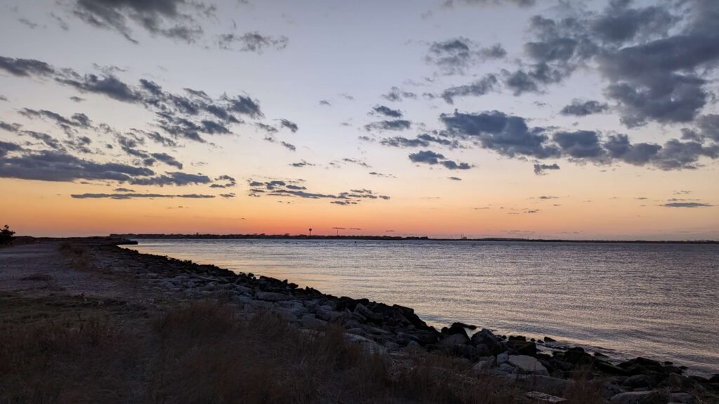
Belmont Lake (Suffolk County). Google Map. The lake has been a reliable night roost for winter rarities including Barnacle Goose, Cackling Goose, and Greater White-fronted Goose.
Betty Allen Twin Ponds Nature Park (Suffolk County). Google Map. Town of Huntington park. From Route 110, turn east on Route 25A (Main St or Fort Salonga Rd) towards Centerport. Entrance is on your right; watch for sign. Park on opposite side of street.
Blue Chip Farms & Shawangunk National Wildlife Refuge (Ulster County). The place upstate for reliable grassland species in breeding season such as Upland Sandpiper, Bobolink, E. Meadowlark, Grasshopper Sparrow; and wintering birds like Short-eared Owl, Kestrel, and Rough-legged Hawk. 2017 had Henslow’s and Dicksissel.
Breezy Point (Queens County). In winter, we meet at the Fisherman’s Parking Lot (requires permit in summer). Google Map.
New York Botanical Garden (aka Bronx Botanical Garden, Bronx County). Google Map. From Whitestone Bridge, take Hutchinson River Parkway to Pelham Bay Park/ Parkway exit, or from Throgs Neck Bridge, bear right and take Throgs Neck Expressway/Bruckner Expressway to Pelham Bay Park exit 1. Head west on Pelham Bay Parkway and after the park on your right, bear right into Southern Boulevard. Entrance is on your right.
Caleb Smith State Park (Suffolk County) Google Map. Take Northern State Parkway or I-495 to the Sunken Meadow Parkway. Head north to exit
SM3, then east on Jericho Turnpike. Look for the park on your left after driving approx. 2 miles. Park is closed Mondays, in winter also Tuesdays.
Caumsett State Park (Suffolk County) From route 25A in Huntington, turn north at West Neck Road. Continue over causeway to park entrance.
Celery Farm (New Jersey). Recommended by new QCBC member Nerissa Coan. Website. Google Map.
Central Park (New York County – Manhattan) Refer to David Barrett’s map.
CityBirder Birding Hotspot Maps (NYC 5 boroughs) – compiled by “Citybirder” Rob Jett. Website
Coffin Woods (Nassau County). Google Map. Take route 25A to Wolver Hollow Road (traffic light and police station). Turn north until the road ends, then right on Chicken Valley Road. Stay on this road until the railroad overpass comes into view. Just at the overpass, turn left into the game warden’s driveway.
Croton Point Park (Westchester County). A great place for wintering birds, Eagle Fest, and Owls. We meet at the train station Google Map where there are restrooms, and also bird various spots here before continuing on to the park proper. Entrance fee in season; limited free parking at baseball field before park fee booth.
Cunningham Park (Queens County). Recommended parking, near restroom, access from Francis Lewis Blvd south of Union Tpke: Google Map. The eastbound trail from here to Francis Lewis Blvd is nice woodland habitat. If you cross under FLB, the “southeast preserve” area has a great network of dirt trails through tall trees and includes many vernal ponds. This is a good place for a “five woodpecker species” day – Trail map 1 Trail map 2. Cunningham park is fragmented by various highways and major roads; there is plenty of on-street parking for its various sections. There is good habitat north of 73rd Ave, but be careful – there are well-used mountain bike trails running through there; don’t get run over!
Cupsogue Beach (Suffolk County) This beach at the end of Dune Road in Westhampton is the eastern side of Moriches Inlet. The flats have been excellent for shorebirds and terns; the partial list of exceptional rarities spotted there is Brown Booby, Elegant Tern, Arctic Tern, Red-necked Stint, Common Ringed Plover. The best access is tide-dependent around LOW or best on mid falling tide for easiest access. See here for the tides at Moriches Inlet and remember to use common sense and good judgement when crossing through water! In season fee collected after 8:30 am. Google Map.
DeKorte Park – Hackensack Meadowlands (NJ). As many wetland areas in the New York-New Jersey metropolitan area, the Hackensack Meadowlands have been abused over the past hundred years or so. Once covering 17,000 acres, Meadowlands open space has been reduced by half through development and landfill practices, and what’s left is radically changed from the historic expanse of tidal wetlands and coastal forests. Fortunately, over the past 40 years, there’s been a rethinking about the value of coastal wetlands, and portions of the Meadowlands have been set aside as public open space and wildlife habitat. Richard DeKorte Park is the single largest area set aside, and is a good introduction to how a more environmental approach to the management of the region has developed. NJ Audubon Website. Park here: Google Map.
Delaware River (New Jersey). Take I-80 west to the Visitor Center at the Delaware Watergap. Meet the club there and then proceed along Old Mine Road which follows north along the river. Google Map.
Doodletown (Rockland County) Take I-87 north across the Tappan Zee Bridge to Bear Mountain Parkway, then head north on it to the exit for route 6 East. Follow that to the traffic circle at the Bear Mountain Bridge. Bear right into route 9W south, drive past the traffic light, down the winding hill to
the intersection of a road coming in on the right side. Park immediately past that intersection. A narrow, winding uphill trail leads to Doodletown. Breeding Cerulean and Hooded Warblers abound. Google Map.
Edgewood Preserve (Suffolk County) Located south of the LIE on Commack Road. Good place for Whip-poor-will in summer.
Floyd Bennett Field (Kings County) From the Belt Parkway, take the Flatbush Avenue exit south. The entrance is on your left just before the toll plaza. On trips we meet at the ranger station located on the right shortly after entering the park.
Forest Park (Queens County) Excellent for spring migrants especially Warblers. The famous water-hole is a magnet for warblers and other migrants. From Grand Central Parkway going west, take Jackie Robinson (Interborough) Parkway to the Metropolitan Avenue exit. Turn left and park on the right side of Metropolitan Avenue or along Park Lane South which crosses several blocks ahead. Watch for parking restrictions. Club meets Park Lane South between Grosvenor Road and Mayfair Road. Google Map.
Fort Tilden and Jacob Riis Park (Queens County) From Southern State Parkway, take Flatbush Avenue South exit 11 (Marine Parkway Bridge) across toll bridge. Take Breezy Point exit and turn left into the entrance just past the traffic light. The Administration Building is to your left at the end of the road. For hawk-watch at Fort Tilden, drive past Administration Building to end of road, turn left and drive along ocean to far parking lot. This lot is only available without permit after September 15.
Gardiner County Park (Suffolk County) A reliable and easy location for Seaside Sparrow, Saltmarsh Sparrow, and Marsh Wren. Take Robert Moses Causeway to Montauk Hwy. Go east 1/4 mile. Had Little Egret in 2015. Google Map.
Garrett Mountain (New Jersey) From the George Washington Bridge, take I-80 west to exit 56 (Squirrelwood Road). At the end of the exit ramp, turn left (south) onto Squirrelwood Road. Proceed over I-80 up the hill into the mountain and turn right on to Rifle Camp Road. After a quarter mile make a sharp left onto Mountain Avenue and you will see parking along the road by the park.
Garvies Point Museum and Preserve (Nassau County) From I-495, exit 39N, go 5.2 miles north on Glen Cove Road. Bear left at the fork and continue to end of road (at the firehouse). Turn left for one block, then right at the traffic light. Continue to the end of the road, then turn left. Just after the road curves to the right, make a left turn into McLoughlin Street. Near its end, turn left into Barry Drive which has an entrance to the Preserve. Google Map. Trail Map
Great Swamp National Wildlife Refuge (New Jersey) Take I-80 to I-287 South to exit 33 (Harter Road). Turn left on Route 202 then left on Sandspring Road. Turn right on Hill Road/ Blue Mill Road/Lee’s Hill Road, then left on Long Hill Road. Google Map.
Great Vly Wildlife Management Area (Ulster County) Can be good for Virginia Rail, Sora, and at least twice King Rail.
Hempstead Lake State Park (Nassau County) Take Southern State Parkway to exit 18, head south to last parking lot entrance before the road turns left sharply around the lake. See Map above Parking FEE as of April 2013 On weekends and holidays We meet at Parking Lot 3 (furthest south). Google Map.
Hook Mountain (Rockland County) Part of Rockland State Park. Take Interstate I-87 north from New York across Tappan Zee Bridge to 9W. Limited parking is along US 9W, look for a small pullout on the right side before reaching the south entrance to the Park. Google Map If you reach the Rockland Lake entrance, you’ve gone too far. Follow the yellow blazes marking the trail uphill to the exposed clearing at the summit. There are private residences in this area so be careful not block driveways and heed the “No Trespassing” signs. Or pass Christian Herald Road and go to the south entrance of Rockland Lake State Park and the executive golf course. Do not park near the clubhouse. At the flagpole in the turning loop take the yellow marked trail uphill to the intersection with the blue trail. Turn right and proceed uphill to the summit.
Jamaica Bay Wildlife Refuge (Queens County) Take Southern State Parkway to Cross Bay Boulevard south, exit 17S, then head south. After crossing the bridge, look for parking lot entrance on the right side 1 1/4 mile ahead at the traffic light. Google Map. Shorebird numbers in the nontidal East Pond are best when it is high tide in the bay and mudflats are submerged. Tides here. Trail map of East Pond by Andrew Baksh
Jones Beach State Park (Nassau County) Meadowbrook Parkway south to end. For West End, bear right, follow signs. Daily parking fee $8, ($10 when beach open) Week Ends 6am – 4pm Week Days 8am – 4pm. Our trips usually start at the West End Boat Basin near the Coast Guard Station. Google Map.
Kissena Park (Queens County) A very good location for spring migrants, and with the restoration of the ‘corridor’ an excellent location for fall migrants. especially sparrows. Trips usually begin at the Velodrome parking lot. Google Map.
Lido Beach Passive Nature Area (Nassau County). Free parking. Good location for waders such Tri-colored Heron. Google Map.
Lord Stirling Park (New Jersey). Take Route 287 to exit 30-A. Take North Maple Ave, bear left at fork (Becomes South Maple Ave). After passing stable make left on Lord Stirling Rd. Park at Environmental Education Center on left 1 mile down. Google Map.
Losen Slote Creek Park – Hackensack Meadowlands (Little Ferry, NJ). Just past Moonachie, north of the Meadowlands Sports Complex. It’s a very different area, almost unique in the metropolitan area: a lowland coastal forest along the banks of the Hackensack River. Park off of Rose St west of Mehrhof Rd. NJ Audubon website. Google Map.
Marine Nature Study Area (Nassau County). Very nice boardwalk for viewing the salt marsh and wading birds. Take Southern State Parkway to exit 20S (Grand Avenue-Baldwin). Pass Sunrise Highway, then turn right on Atlantic Avenue. Turn left on Waukena Avenue and start looking for signs to the nature center. Turn left on Park Avenue, then left on Golf Drive to Slice Drive. Google Map . Usually open 9am to 5 pm, closed on Sundays and Mondays – check website.
Marshlands Conservancy (Westchester County). County park. Google Map.
Massapequa Preserve (Nassau County). A good place to start the trail is at the boat launch – Google Map.
Mecox Cut (Suffolk County) Parking free before 9am or after 5pm. At other times, a Southhampton beach permit is required from July 1 to Labor Day – without it, you may incur a hefty fine and they patrol often. Mecox Bay exits to the ocean through a cut. The sand bars often have shorebirds. “Cut Beach”. Google Map.
Mianus River Gorge Preserve (Westchester County) Park opens at 9am. Google Map.
Montauk Point State Park (Suffolk County) Take I-495 east to exit 70. Turn right and go to end of road, then turn left into route 27. Follow along route 27 to end of road. Parking free before fee collection starts – 8am. Our trips usually begin at the Lighthouse Cafe, park here: Google Map.
Muttowntown Preserve – Northern part near Chelsea Mansion (Nassau County). Park here – Google Map.
Muttontown Preserve – Equestrian Center (Nassau County) Park here Google Map. Open fields sometimes have Eastern Bluebirds.
Nassau County Museum of Art (Nassau County) From Northern State Parkway (exit 28) or I-495 (exit 37), take Mineola Avenue north to route 25A. Turn right and drive across viaduct. On top of the hill, make a left turn into the museum area. Closed Mondays. Google Map.
Nickerson Beach (Nassau County) Parking fee collected in season between 9 & 4pm; free if you arrive before or after. Daily fee is high: $15 for Nassau County resident “Leisure Pass” holders and $37 for all others. A great place in season for Terns: so far in May & June 2017 Common, Roseate, Least, Royal, Black, Arctic, Sandwich. Breeding grounds for Piping Plovers, American Oystercatchers, Common and Least Terns, and Black Skimmers. Google Map.
Norman J. Levy Park (Nassau County) Take Meadowbrook Parkway to Merrick Road and drive east. Turn right immediately after passing parkway (Sanitation Dept. entrance). Park here: Google Map.
Oakland Lake – part of Alley Pond Park (Queens County). Scenic path. Especially good for winter ducks. Meadow on opposite side of Cloverdale Blvd is good for butterflies. Google Map.
Overpeck Park (New Jersey) Take I-95 across George Washington Bridge and turn-off to New Jersey Turnpike. Take the first exit (Route 46, Ridgefield Park) to end of street and turn left. Drive two blocks to left turn for route 46 East. After making the turn, bear left, cross over I-95 and turn left. Drive to end. Caution for exit from Overpeck Park. To go east, follow entrance sign for I-95. To go west, drive forward to route 46 and turn east.
Pelham Bay Park (Bronx County)
Planting Fields Arboretum State Historic Park (Nassau County) Take route 25A to Wolverhollow Road (traffic light and police station). Turn north until the road ends, then right on Chicken Valley Road. Pass the large gate of Planting Fields, and turn right at the next road, Planting Fields Road, which leads to the Arboretum. NYS State Park vehicle fee may apply. Park here – Google Map. Trail Map.
Plumb Beach (Kings County) Free but limited parking. Has been a reliable location in spring for Nelson’s Sparrow (usually a fall migrant). 2017 has had at least two Subvirgatus aka the Atlantic race. Clapper Rails numerous here. Has also had other good shorebirds such as Baird’s Sparrows best found at HIGH tide. Google Map.
Point Lookout (Nassau County) This inlet often has rarities of one sort or another, like Black-headed Gull, Little Gull, Ross’ Gull (once) Eared Grebe, Red-necked Grebe. On-street parking may be limited, and is a few blocks back from entrance – Google Map. Alternative, not in summer: Town Park at Point Lookout – Google Map.
Prospect Park (Kings County-Brooklyn) We meet at this entrance, just north of Empire Blvd – Google Map. A more detailed Prospect Park map is available here from Rob Jett’s City Birder website.
Quaker Ridge Hawk Watch (Connecticut) Located on the Greenwich Audubon Center.
Ridgewood Reservoir – part of Highland Park (Queens and Kings Counties). View treetop birds at eye level from the elevated walkways. Park in lot just east of Vermont Place. Google Map.
Robert Moses State Park (Suffolk County) We meet at the west end of Field 2. Google Map. The Hawk Watch is located east of Field 5. Note: do not park by platform, one must park in a lot. NYS State Park fees apply.
Rockefeller State Park Preserve (Westchester County) This site hosted two, possible three Kentucky warblers in June 2011! Here is a map marked with their locations.
Sands Point Preserve (Nassau County) Google Map. Take I-495 to exit 36, then north on Searingtown Road which turns into Port Washington Boulevard (route 101). Continue past Port Washington, then watch for entrance 1 1/2 miles ahead on your right. Permission required due to COVID; call 516-883-1612. Parking fee of $10 to $15.
Sharon Springs (Schoharie County) Take 87 north to Albany, continue on I-90 Thru-way westbound. Connect to 20 west to Sharon Springs. Meeting location is corner of Kilts and Goodrich roads. Historically good for Henslow’s Sparrow. Grasshopper in area, as well as nearby Upland Sandpipers and Mississippi Kites not too far away.
Shawangunk National Wildlife Refuge and Blue Chip Farm (Ulster County). The place upstate is for reliable grassland species in breeding season such as Upland Sandpiper, Bobolink, E. Meadowlark, Grasshopper Sparrow; and wintering birds like Short-eared Owl, Kestrel, and Rough-legged Hawk. 2017 had Henslow’s Sparrow and Dicksissel.
Shirley Chisholm State Park (Kings County – Brooklyn). Landfill restored as grasslands habitat, plus marshlands bordering Jamaica Bay. Note opening time of 9am. Website. Google Map for parking.
Shu Swamp Nature Preserve (Nassau County) Take route 25A to Wolver Hollow Road (traffic light and police station). Turn north until the road ends, then right on Chicken Valley Road. Pass planting Fields, and turn right at the blinking light. Drive along the pond at your left, turning left, and continue until you reach the sanctuary parking lot on the left side, just before LIRR overpass. No street parking. Closed Fridays. Google Map.
South Shore Potpourri (Nassau County) This is a tour of several south shore ponds etc. We meet at Lofts Pond Park in Baldwin, on Windsor and Merrick Road. Google Map Take Southern State Parkway to Grand Avenue (exit 20 south). Turn right on Merrick Road.
Staten Island hotspots (Richmond County) Several excellent spots are on the island.
Stehli Beach (Nassau County) From route 25, 25A, I-495, or Northern State Parkway, take route 106 north into Oyster Bay. Make a left turn at Lexington Avenue (Berry Hill Road), then left when it ends. Follow this road along the bay into Bayville. Turn left at the traffic light at the end of the road. Drive through Bayville. Just before the road turns sharply to the left, turn right into the beach parking lot. Residents only in summer. Google Map.
Sterling Forest (Orange County) Reliable Golden-winged Warbler location, with one recent breeding of Mississippi Kite. Take the I-87 to Sloatsburg Exit 15A, continuing North up Route 17 through Tuxedo. Beware that Tuxedo is a notorious speed trap so obey speed restrictions. On your left will be a small plaza with a Dunkin Donuts and Hayward’s deli (845) 753-2016 that makes good sandwiches. A short distance further will be Route 17A. Turn left, and continue to CR 84/Long Meadow Rd, where you will turn left again. There is a pullout on the right a short distance up the road alongside this lake.
Stillwell Woods (Nassau County) Take Route 25A east past route 106 until you pass the nursery. At the next intersection where Route 25A veers to the left, turn right into Cold Spring Road. Proceed until a road branches off half-left. Take this road, Southwoods Road, until you see the school property at your right. Turn left into the dirt road just before you reach it and park. Google Map.
Stone Bridge Nighthawk Watch (Suffolk County) run by Four Harbors Audubon Society website. Hundreds of Common Nighthawks during fall migration, starting the end of August. Directions: Long Island Expressway to Nicolls Road (Exit 62). Take Nicolls Road north to the end where it joins State Route 25A. Make a right heading east on 25A. Make left at first light onto Main Street. Take this north to end where it forms a t-intersection. Look to left and you will see the stone bridge crossing over water. Make a right and immediately find a parking space on the road across from or near the old Setauket Post Office. Park near here Google Map. Nighthawk watch is just to the west, on the other side of Main Street.
Sunrise Mountain (New Jersey) Take I-80 in New Jersey to Route 15, then follow it. Continue as it turns into Route 206. After passing Culver Lake watch for a right turn with a pointer to the mountain. Shortly after making that turn, turn half left into the road leading to the destination.
Sweet Briar Nature Center (Suffolk County) Take Sunken Meadow Parkway to Jericho Turnpike. Drive east into Smithtown. Turn left on Edgewood Avenue, then left on Landing Avenue, and another left on Eckerkamp Drive. Watch for parking lot sign. Google Map.
Target Rock National Wildlife Refuge (Suffolk County) Follow directions given for Caumsett State Park but continue straight ahead into the refuge. Google Map.
Teatown Lake Reservation (Westchester County) Take the Taconic Parkway to Route 133 and turn west, then right turn on Spring Valley Road.
Theodore Roosevelt Sanctuary (Nassau County) From route 25, 25A, I-495, or Northern State Parkway, take route 106 north into Oyster Bay. Turn right on Cove Road and go two miles till you find the cemetery parking lot at your right. Park and walk east along Cove Road to the sanctuary entrance. Google Map. Website.
Tiffany Creek (Nassau County) From route 25, 25A, I-495, or Northern State Parkway, take route 106 north into Oyster Bay. Turn right on East Main street and drive past the school. Do not turn here but look for a right turn shortly thereafter into Sandy Hill Road. The sanctuary entrance is on the right. Google Map.
Timber Point Golf Course (Suffolk County) In recent years some rarities have shown up here including Ruff and Dovekie. From last exit on Southern State/Hechscher Pkwy, go east on Timber Point Road / River Road to join with Great River Road. Google Map.
Uplands Farm of The Nature Conservancy (Suffolk County) Take route 25A east past fish hatchery. Bear right into route 108 but turn left immediately into Lawrence Hill Road. Entrance is on the right at 0.4 mile. Google Map.
Van Cortlandt Park (Bronx County) Take Major Deegan Expressway to Van Cortlandt South. Turn east and left at next light. Park in Golf Course lot.
Ward Pound Ridge Reservation ( Westchester County) Breeding Louisiana Waterthrush, Pine and Worm-eating Warbler. Take the Hutchinson River Parkway to I-684 and drive to exit 6 Katonah / Cross River – Route 35 East. Turn right and follow route 35 into Cross River. Turn right on route 121. Park entrance is immediately on left side. Free before 8am.
Welwyn Preserve (Nassau County) From I-495, exit 39N, go 5.2 miles north on Glen Cove Road. Bear left at the fork and continue to end of road (at the firehouse). Turn right. Turn left on Desoris Lane. Turn left on New Woods Road and drive to the end. Turn right. Entrance is on your right. Google Map.
Wertheim National Wildlife Refuge (Suffolk County) Take Long Island Expressway to exit 67 and go south on Yaphank Road. At the Horse Block Road intersection bear half left toward Montauk Highway. Turn left on Montauk Highway and right on Old Beaver Road which turns into Smith Road. Entrance is on the right. Google Map.
© 2024